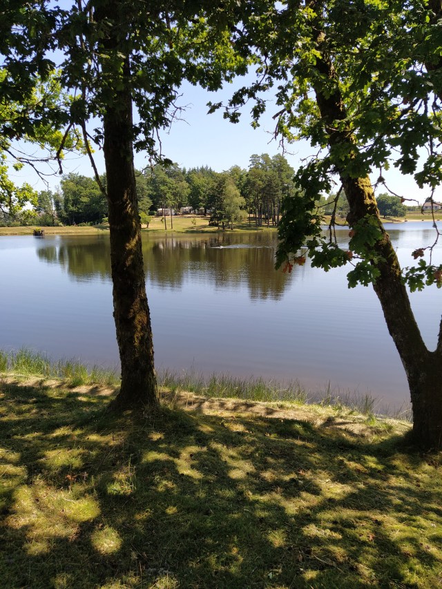
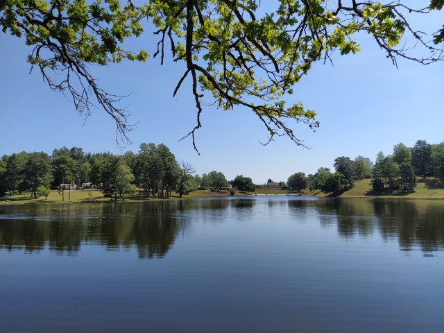
Another lake, another swimmer. But technically, this isn’t a lake or etang. It is a plan d’eau. Plan d’eau is a catch all term for a stretch of water used for leisure activities such as the river Cele at Marcilhac. The nearest one to our village is where the Cere widens and curves just before a small wier. A beach of sorts has formed on the outer side of the bend and is used by a nearby campsite. The one at Auriac looks like the manmade variety and we could see a rather plain embankment whose sole purpose appeared to be to hold the water back or in.
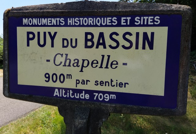
But I’m ahead of myself. Today’s trip started with a visit to the Puy de Bassin a few kilometres down the road from this particular plan d’eau. We had driven to Argentat taking the route of two weeks ago, the ‘fish farm road’ but from Argentat had taken the road northeast up across the Xaintrie, the old name for the area. Typically, the gps had ideas of its own about the route it should offer us and left the main road at St Privat and proceeded to take us down narrower and narrower roads until we had barely enough space to negotiate our way around occasional cyclists and even rarer oncoming cars. Mind you, the road from Darazac and through the forest Duzejouls was beautiful and when we drove past about five or six huge log stacks the car filled with the smell of resin.

‘i’m only the chauffeur’ hadn’t been able to find the Puy de Bassin, my intended first stop, on the car gps so we came to the plan d’eau at Auriac first. We drove on Into the tiny village full of slate roofed house and a slightly forbidding church and took the road for the Puy. As I had hoped the turning for it led to a decent tarmac road albeit narrow that took us to a parking area. Getting out of the car we could hear a humming noise and soon realised there was an enormous phone aerial nearby. Well, it is advertised as the highest point of the Xaintrie.
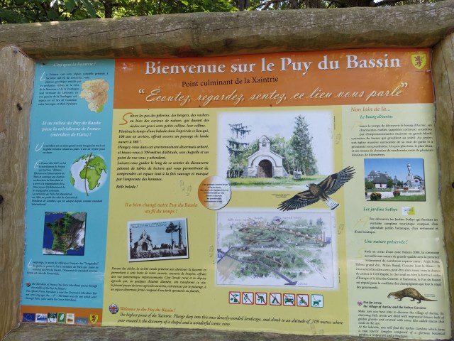
There were several information boards telling us about the flora and fauna. Otters (?) and booted eagles. And a sign for a six kilometre walk. Lou perked up at the thought while I didn’t. Well, not today anyway. Another time perhaps?
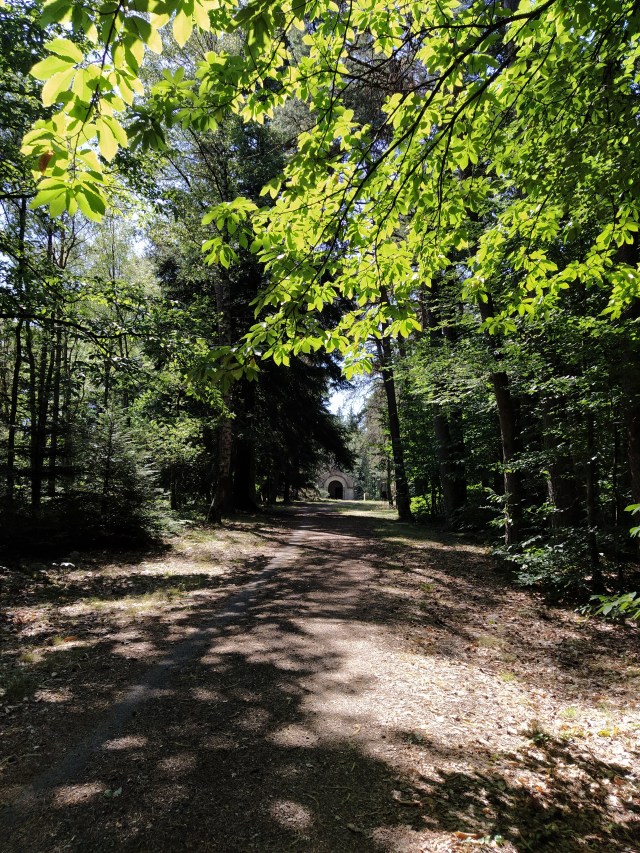
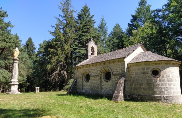
A wide track led up through the pine trees to a green space with a chapelle and a statue of the virgin Mary on a very tall column. There was also a rectangular stone thingy and an old fashioned camera set up pointing at the scene.
One of these edifices marks the green meridian which cuts through Paris. We cross it on visits to Aurillac (spelt differently!) and Puy Mary. I’ve read that to celebrate the millennium events were held in towns and villages along it.

(I wondered if the English translation was a touch of local French pique, letting les Brittaniques know they weren’t best pleased to lose out to Greenwich!)
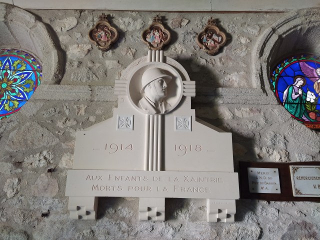
We took photographs but couldn’t see the view as, despite being at the highest point, the surrounding forest blocked out everything. The chapelle was unlocked so we were able to go inside and look at the stained glass and memorial to the fallen of the two world wars. ‘Mort for la France’, this phrase is intoned at armistice ceremonies all over France after each name of the fallen for the particular community is read out. So always poignant to come across those words, especially in a beautiful place on a peaceful day. A group of children had clattered around the chapelle as we had arrived but only tried the door. Perhaps they should have been encouraged to go in and reflect.
There were none of the advertised picnic tables and with the six kilometre walk put off for another day it was back to the car under the humming aerial and back to Auriac.
Earlier we had driven past what we thought was a parking area for the plan d’eau but it turned out to be for the Sothys gardens nearby. Luckily there was some flattish land just above the water on our left so we drive onto it and parked. A bit anxious about the legality of that but the plan d’eau was just below us so we wouldn’t be far away if a jobsworth turned up and wanted order us off!

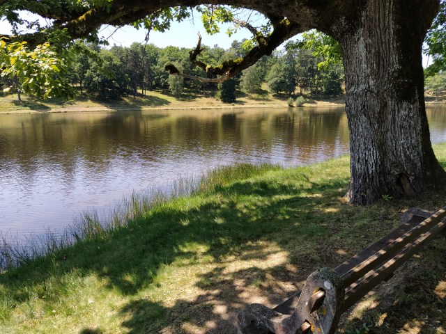
Picking our way carefully down the bank we found a bench perfectly placed for our picnic lunch. So beer out, himself, cappuccino made, myself, we relaxed and enjoyed the view. The swimmer made a circumnavigation and then seemed to disappear. We hoped he’d made it to the far side from where we could hear excited children playing in the water.
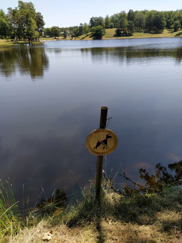
Lunch finished and the sun getting hotter as our shady patch wasn’t that shady anymore we decided to walk around the plan d’eau. I had read online there were ‘bornes’ placed along the walk with relevant information. It was thanks to one that I learned that there was a source that ran into the water. source always sounds so romantic but this appreared to be a ditch watched over by a few cows. Most if the others were pretty faded but we could just make out that we were passing a very old oak and later a very old chestnut.
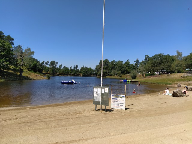
The squeals and screeches were coming from children messing about with canoes next to a pontoon and some in the water by the “beach’. We spotted the official car park. Up this end there the obligatory commune tennis court and boule pitch as well as crazy golf. There was the municipal campsite which looked very inviting under its shady trees. One to remember for when times improve?
Benches and picnic tables were placed around and about and there was a holiday atmosphere as we passed groups also picnicking, sunbathing or fishing. All the things you envisage at a plan d’eau but surprisingly restful due to not being overcrowded despite it being mid July and school holidays.
Back at ‘our’ bench it was time to turn for home and pick our own route rather than that of our goat track loving gps. St Privat here we come, the less windy way!