After nearly being blown away on the plateau de Tauves Lou asked if there was a walk closer to home. There is but it involves a lot of climbing, I replied, and I’m slightly anxious that, once more, there is a part of the walk marked on the fiche that doesn’t have a corresponding path marked on the ign map. Well, that was like yesterday and there was a wide farm track, he replied, so resistance was impossible.

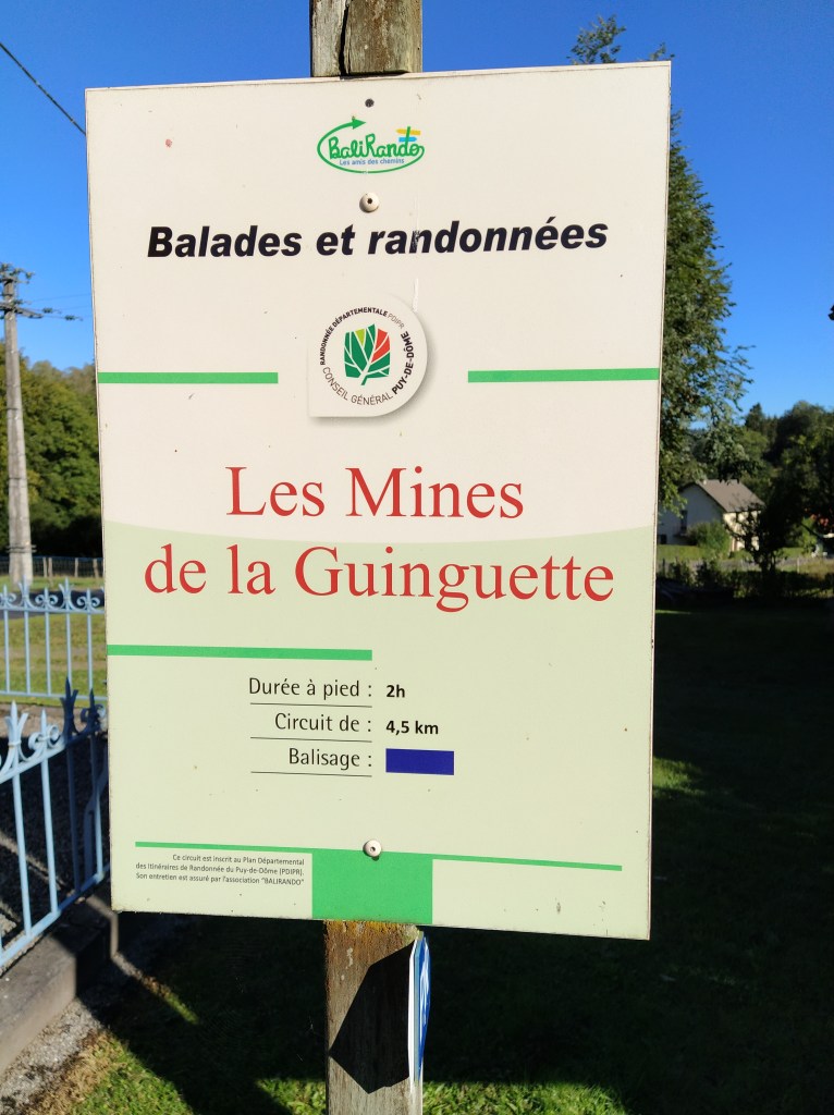
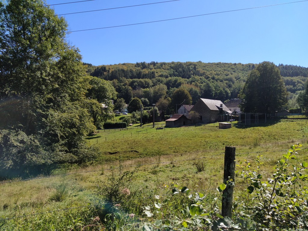
Given the walk started and finished just above the campsite (well, two kilometres away) we didn’t bother with a picnic, deciding to come back for lunch. Not wanting to add four kilometres to a walk that already looked pretty exhausting, (345 metres of climbing, about 1000 feet in old money) we drove up to la guingette, the starting point. There is no carpark near the start of the walk so ‘i’m only the chauffeur’ squeezed us onto the verge and I turned the side mirror flush with the door.
We walked down to the sign for the walk which was next to the war memorial, an odd edifice departing from the norm by having four shell like obelisks (as in military shells) around it which were painted bright blue. Across the road and around the corner past a trickling water pipe that was labelled water non analysed (?) we started the climb next to another memorial.
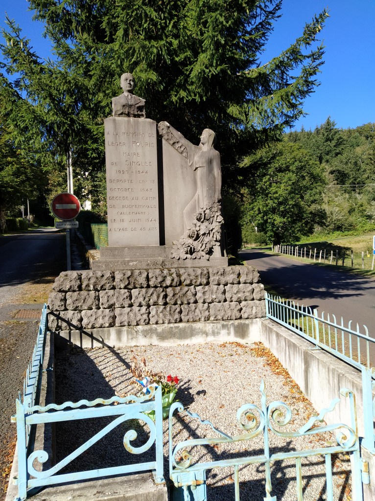
This one was more specific and commemorated a former Maire of Singles who had been in the resistance but was informed on and arrested. After spending time in a detention centre he was deported to Buchenwald where he died within a year of pleurisy. In the middle of this beautiful countryside there are reminders of the violence and horror that took place just before mine but within Lou’s lifetime. A sobering thought.
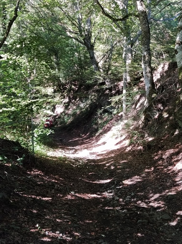
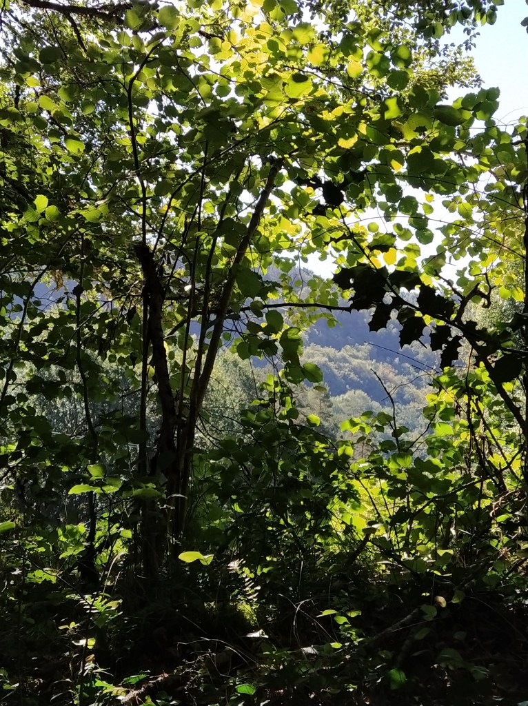
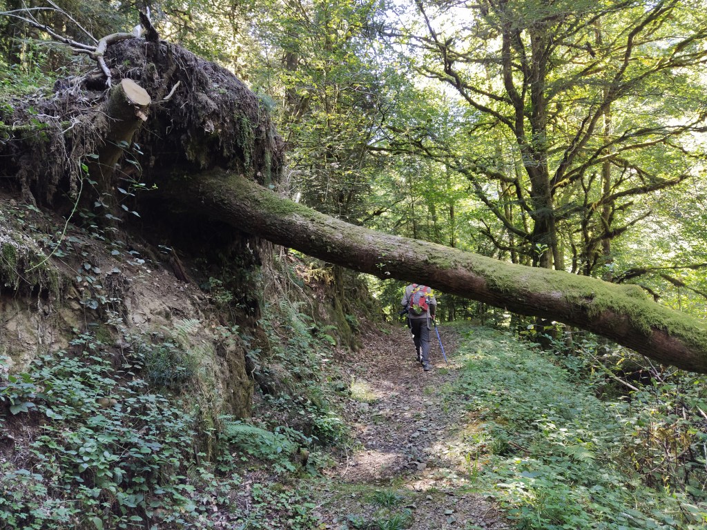
The tarmac road gave way to earth and stones and we were trudging up a holloway, the banks level with my eyes but giving glimpses of the beautiful Burande valley.
After a while we came back onto the main road up to Singles. The hillside fell away to our left as we climbed higher. You must be fit to live at this altitude. We wondered about the number of cars parked in every available space and as we walked up past the church we realised there was a funeral taking place. Another sobering reminder of mortality and the need to be grateful for being able to do this kind of activity in freedom and good health.

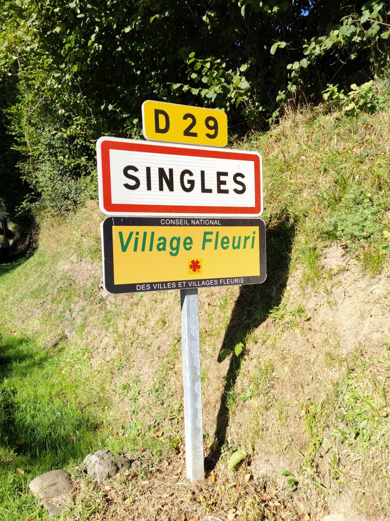
The road we were on became steps that led up to the mairie. The village sign said Singles was a ‘village fleuri’ and it really is. Beautiful flowers bloomed everywhere. I peeked into the Marie windows at a meeting room. A sign of the times that at every place at the table the ubiquitous bottle of water has been replaced with a bottle of hand gel.
Another turn, up another slope and through more pretty cottages with flower filled gardens. We walked past a barn whose shape I’m beginning to recognise. Very tall with a steep high pitch to the roof. Protection against snow, himself believes.

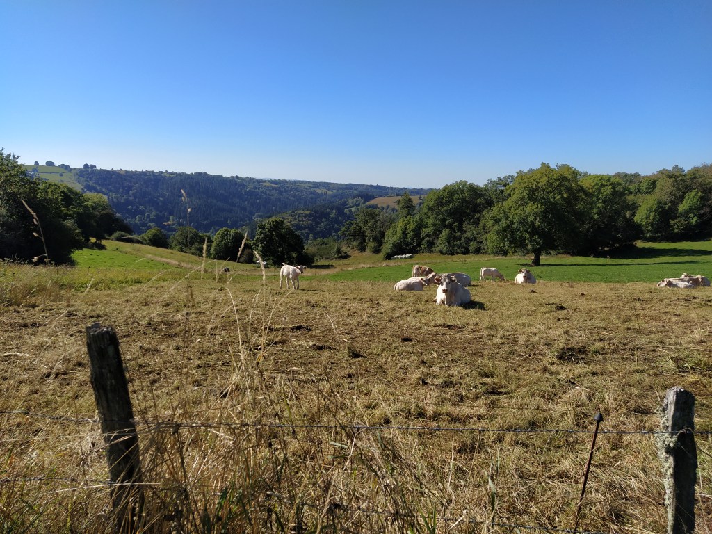
Now we were walking away from the centre ville between fields where cows lazed and the far hills were hazy in the heat.
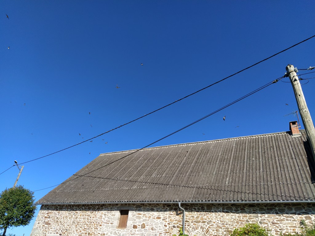
As we came to a farm on our right swallows (or maybe, housemartins) swooped and dived and chattered as they briefly came to rest on the telephone wire above our heads. I stood still and enjoyed their frenetic movement knowing I could never capture their excitement in a photograph.
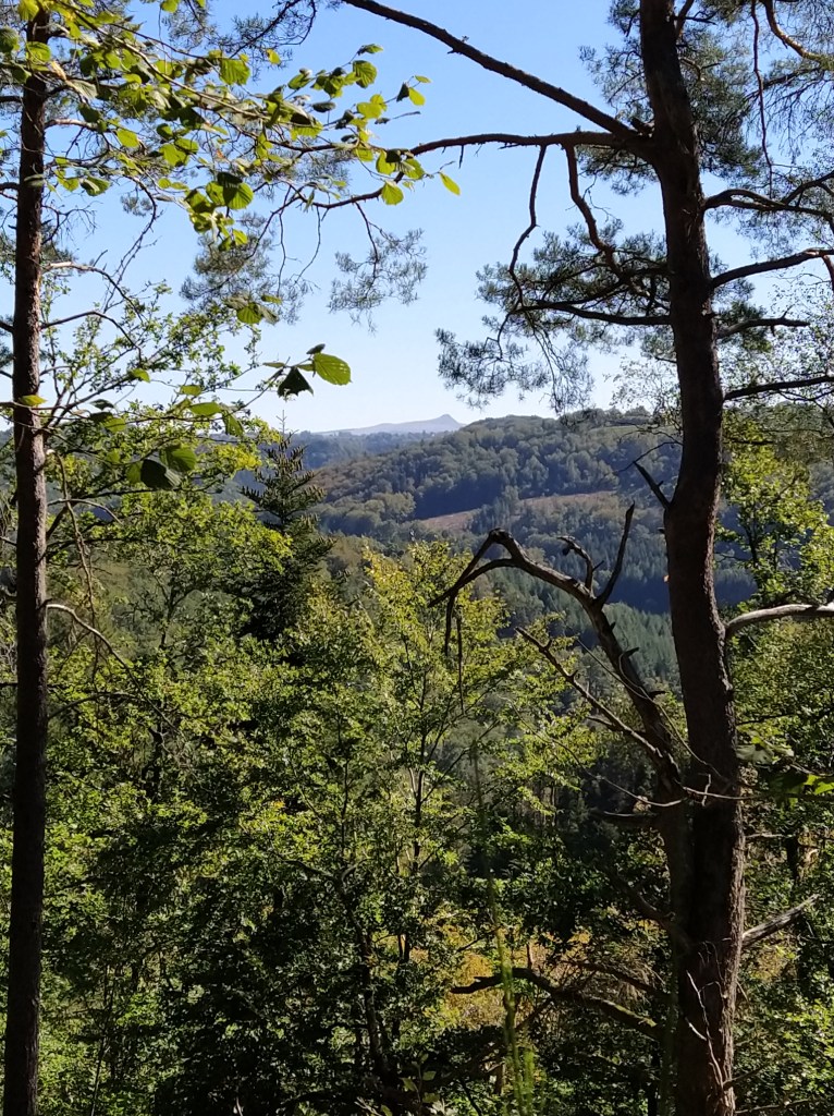
The blue balise, yes, blue today, took us to the right around the farm and its buildings. As i came around the end of the barn I let out a ‘wow’. Suddenly we were looking across the hilltops to the Massif de Sancy.
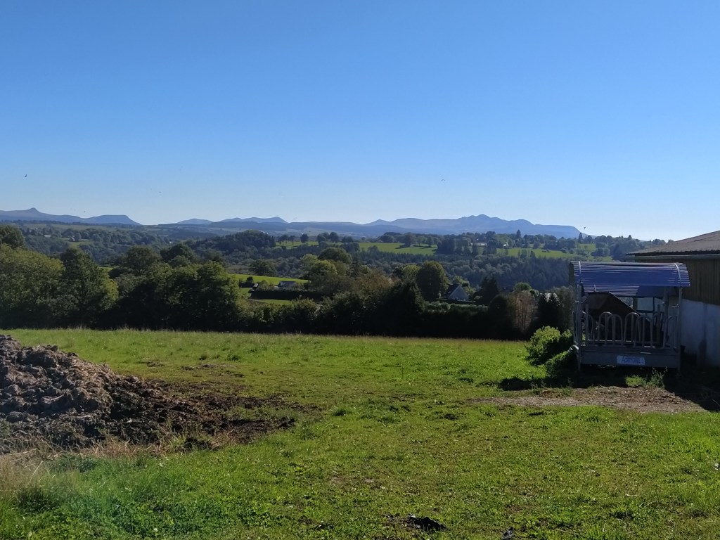
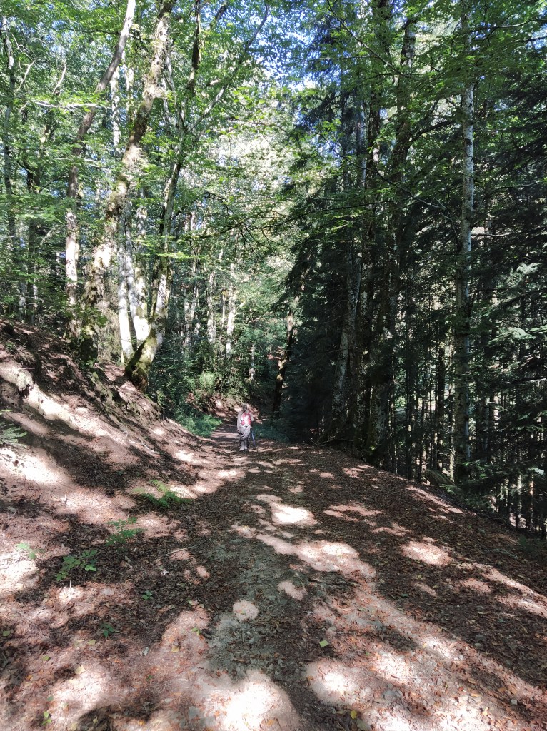
We had seen it the day before but it had been a constant during the walk. This was a sudden sighting and as we walked further and slightly downhill it was lost from sight again. We were on a farm track now and dropped quickly down into woodland which became denser and with more pine trees. It looped back and forth very pleasantly with dappled sunlight and birds calling to each other.
I noticed lots of beech trees and rescued a tiny sapling from one of the ruts in the track. Naughty but it wouldn’t survive there. Better in a pot at home and cared for!
The track went down and down … and down, looping around hairpins with broken branches and shifting stones lying in wait for a careless step. It was a lovely walk but ‘we’ll have to climb back up at some point’ I called to himself, always yards in front.
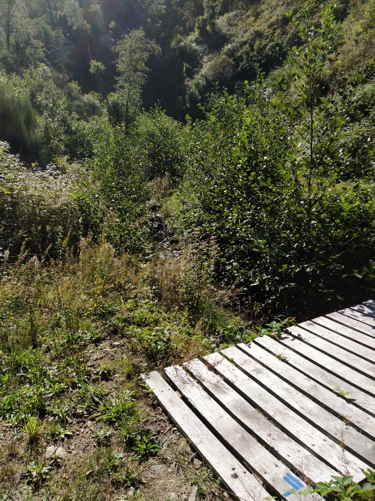
Then the track with its double ruts disappeared on a sharp bend. We could see a path of sorts leading away to our right and could hear a stream tumbling somewhere below us. There were still blue balise on the trees so we were on the right track…except there was no track. And soon, there was barely any path! We could just make out a slightly smoother path across a very steep slope falling away to our left. The next ten minutes were scary. We made it by helping each other out, grabbing at anything that looked a strong enough handhold and not thinking about how to explain to the pompiers exactly where the slope was that one of us had just tumbled down!
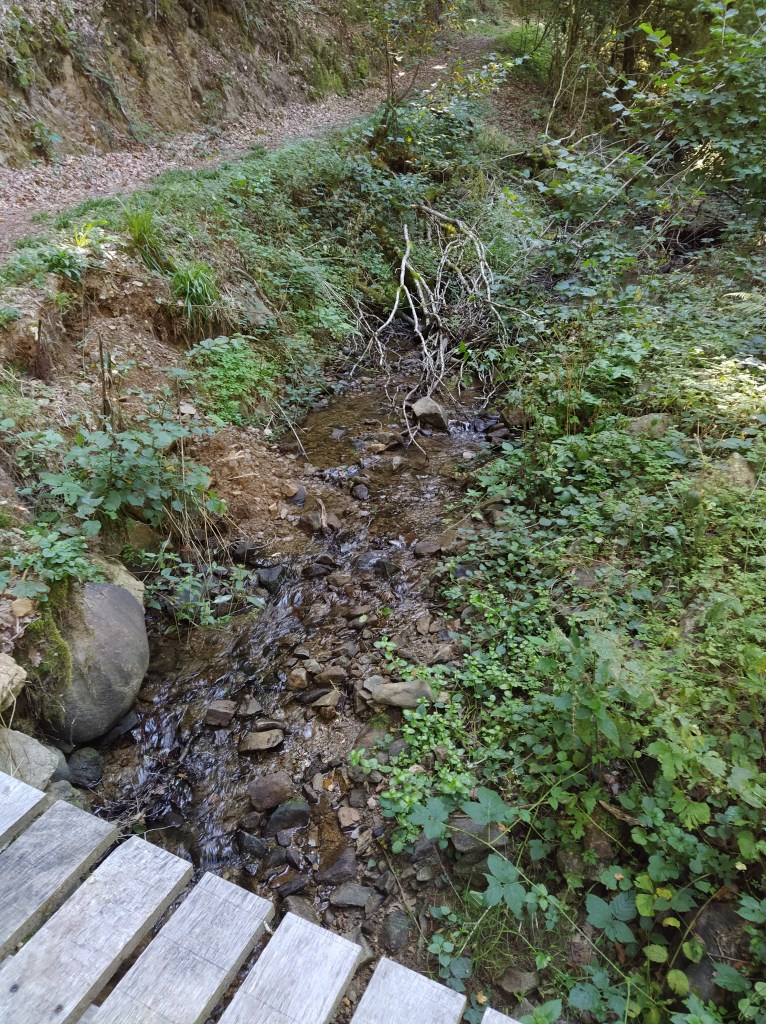
Safely across and back on a wider path the blue bars were still taking us to the right although the sound of the stream was to our left now. The fiche showed the path crossing a stream and, then, suddenly, there was a plank bridge over a stream, obviously the one making more noise further down.
Comparing the map to the fiche we were in the no-mans land of the IGN. Not surprising given the state of the path we’d just struggled along! Once, when walking in the Haute Savoie there had been ropes strung along certain dodgy sections of the path. We could have done with a good strong rope back there!
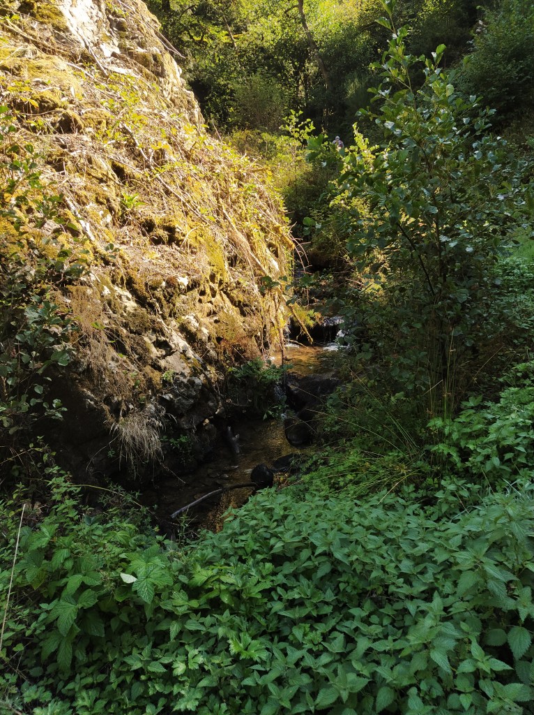
As if to compensate us for our fright, the path now led us under a fallen tree, across the stream again and into a tiny hidden valley of verdant green in full sunshine. After being under the trees for so long it was magical. The water tumbled down some rocks at the far end. ‘Waterfall’ called back himself, ‘Cascade’ I replied, always ready to try and teach him some French!
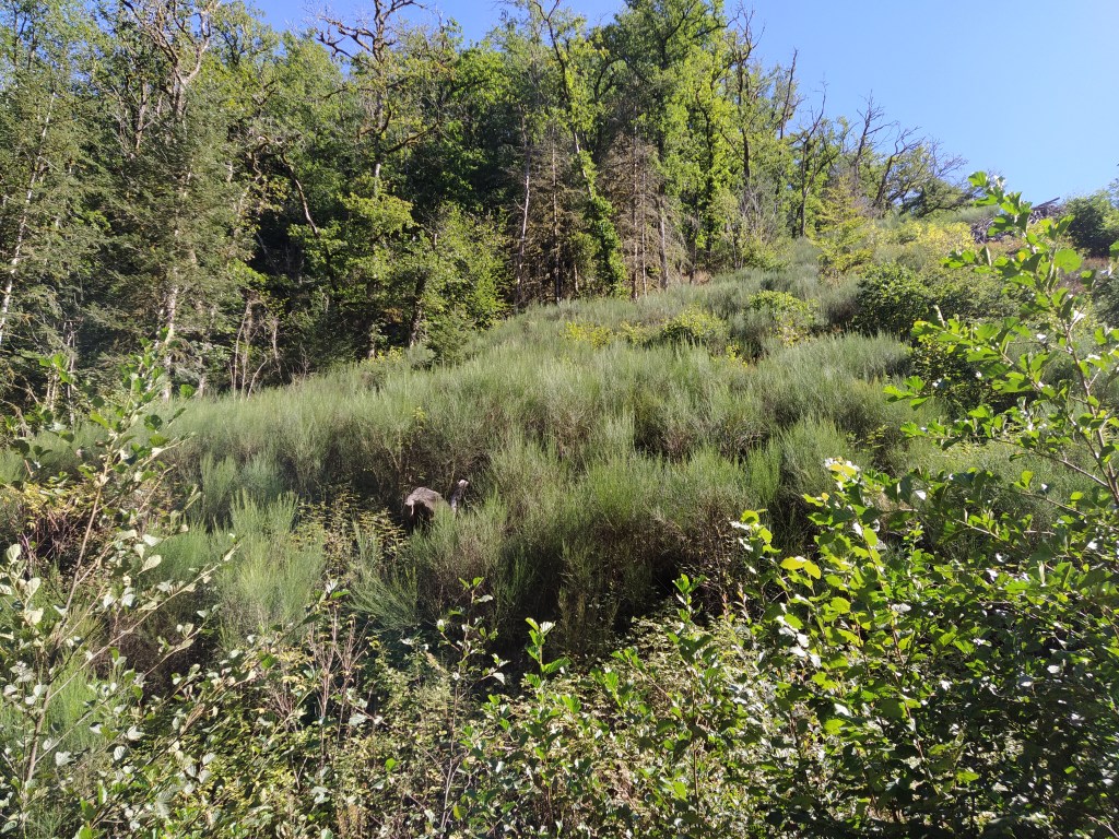
Now the climbing began. But a decent track along and above the stream which dropped further and further below us as we climbed back under the trees. Big rocks covered in moss lined the track until we started to come out into more open countryside. Grassy verges took the place of the rocks and soon we could see across the fields to our car parked by the road.
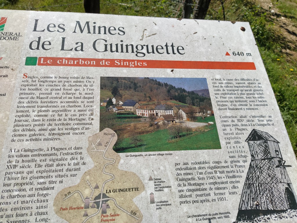
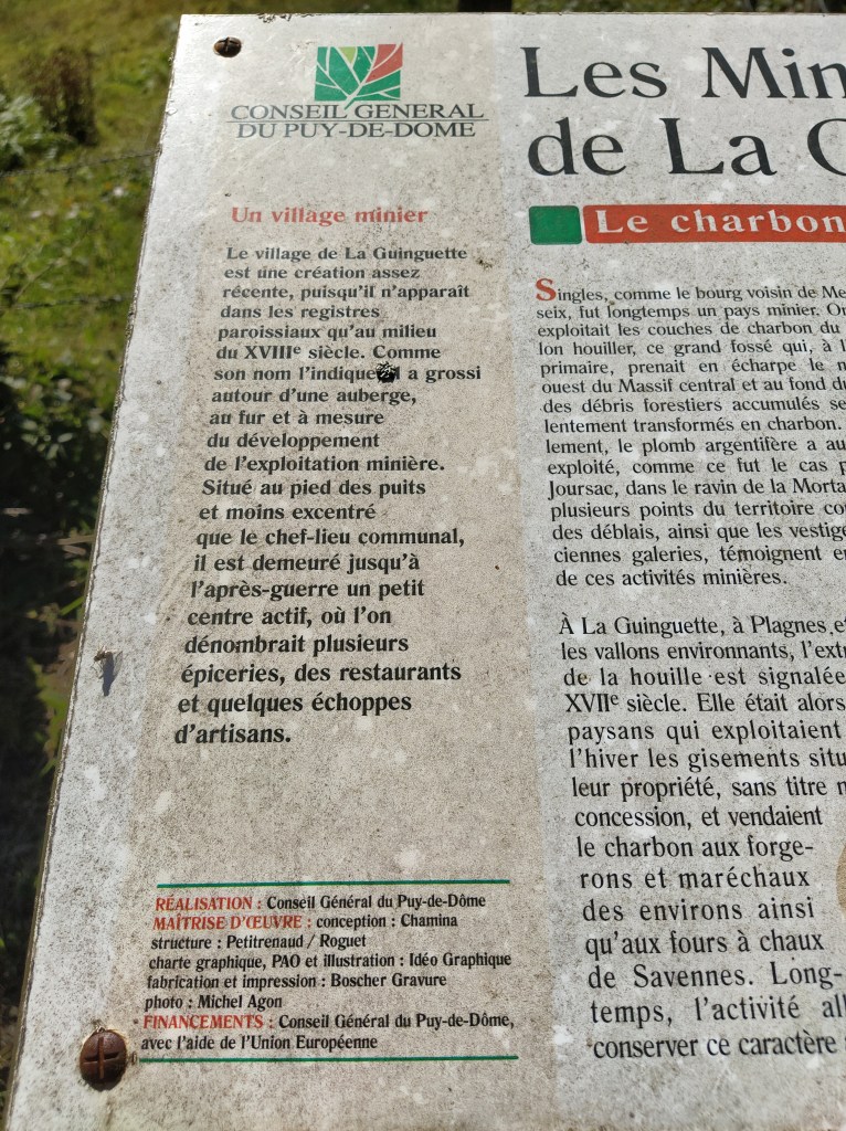
As we approached the village there was an information board beside the path telling of the history of la guingette, which means a cafe cum dancehall. When there were gold mines in this area, the workers came to the guingette to relax, the only building at the time, the mid 1700s. Later, more houses were built. The mines carried on for some time but the old galleries and the railway that served them were all drowned when the Dordogne was dammed at Bort les Orgues. This walk was meant to give us a feel of those times but I can’t say they did without knowing more of the history. Did they pan for gold down in that pretty valley?
Back in la guingette the bar/restaurant that bears the same name was shut so no beer and cappuccino for us. We noticed it had a cafe associative sign on the door. This is a movement in the French countryside where volunteers open up defunct bars in their village so that the inhabitants have somewhere they can still meet up for a chat. However, the opening times can be a bit hit and miss for thirsty walkers!
Back to the campsite for lunch and a snooze
