Except we hadn’t. Last week it was a case of a walk that seemed be non existent, this week it was a whole village!
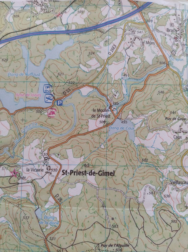
I had looked at a little etang online and when researching information about it found a walk that passed by it. Google earth revealed a decent parking place next to the village church so having printed off the fiche for the walk it was all systems go. My meteo said some showers, his said no rain so off we went. Northwards this time into the Correze. I thought it was a bit odd that after passing Tulle we were on a road that I knew was on the northern side of the A89 autoroute but decided the bigger road was better than wiggling along those twisty lanes ‘i’m only the chauffeur’ doesn’t enjoy. At any moment I expected the GPS, usually a lover of goat tracks, to take us down a right turn. But that didn’t happen. On the main road in the middle of Gare du Correze our gps announced we had ‘arrived at our destination’. ‘No, we bloody haven’t’, I retorted. Lou checked the address he had entered which was indeed Saint Priest de Gimel but we weren’t in it.
Fortunately, on checking with the map and proving that the village was clearly marked south of the autoroute, we found we were near the D26 which should deliver us to the correct place. Of course, there is always trial and error. Not least when you are presented with a fork in the road that has both possibilities carrying the same road number! A short backtrack once I recognised we were on a part of the walk and once past the etang (thank goodness) we drove up a hill, around a bend and there was the tiny church on our right.

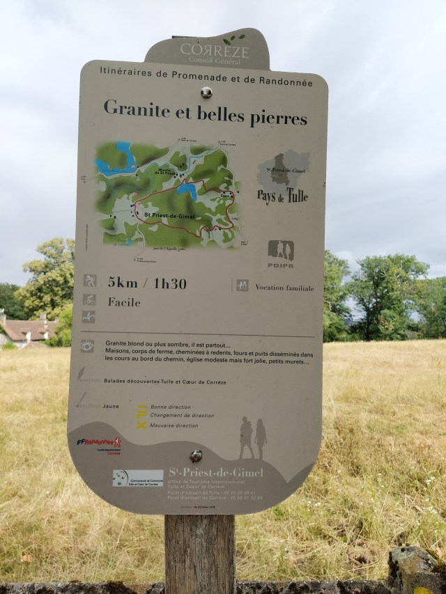
We parked up and tried to ignore the menacing black clouds coming from the direction we hoped to walk. Sensible shoes and raincoats we decided. I was very pleased to find a notice board with the name of the walk and the start of the yellow balise that would lead us around the five kilometres to come
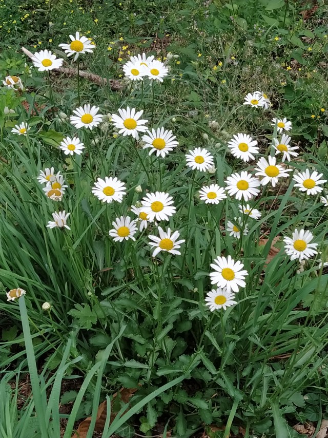
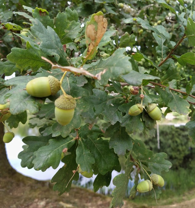
The usual faff as forgotten bits are retrieved and then we began. The route was ‘sur la route’ until we got to the etang. The small hill we had just driven up, in fact. The Correze is logging country and we walked down between huge stacks of logs smelling gorgeous. Around them the grass verges were full of wild flowers. After our dried up straw like roadsides back home it was refreshing to see. As was the rain that started to fall!

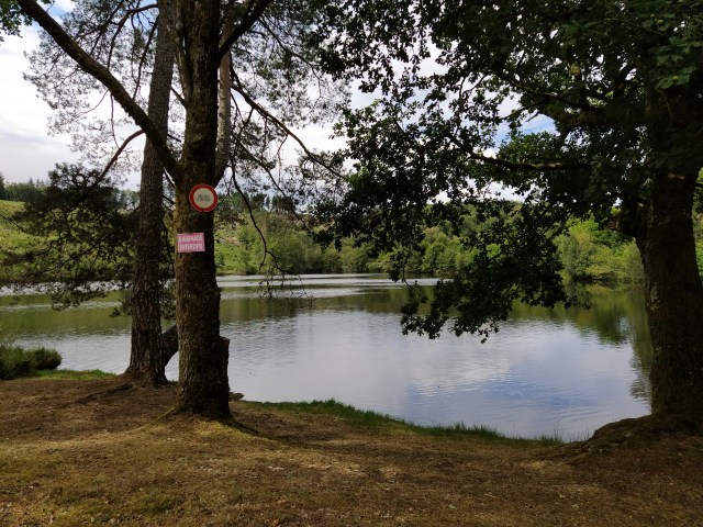
By the time we reached the edge of the etang de Caux the rain had stopped, and so did we to enjoy the tranquil view of the water. Its owner clearly enjoyed it too, to the extent of slapping up a wire fence and three signs with various interdictions…no camper vans , no entry etc.
We took the hint and moved on. My researches had revealed this would be a walk on farm tracks, no slithering over rocky, plum smeared narrow paths between fields, and so it was. We walked up towards the plateau de Caux as my fiche told me. The etang could just be seen between the trees behind and below us.
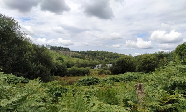
The landscape was a mixture of woodland and fields with rocks and heathers beside the track as we climbed higher.

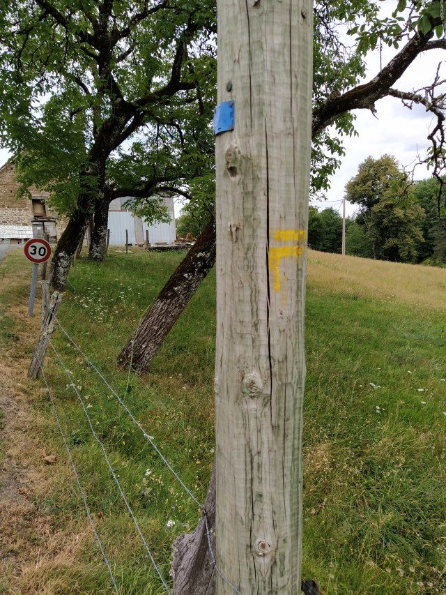
Finally the track flattened out with views of woodland and we came into s tiny hamlet. Caux, I believe. The first people we’d seen were chatting outside a house and waved us to the right as we searched in vain for a yellow balise.
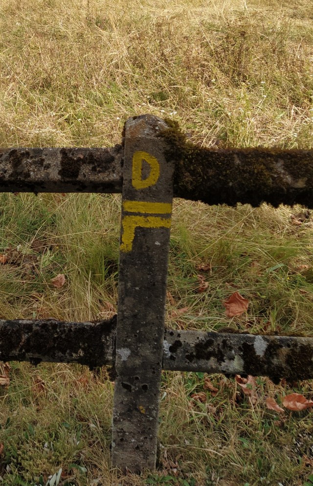
With a bonjour and a merci we walked down past a precarious old barn and noticed a tiny yellow splash on one of its stones. Now we were on a main road and heading uphill…again. Himself wasn’t convinced we were going in the right direction but this bit I had seen several times on Google earth so strode forth! 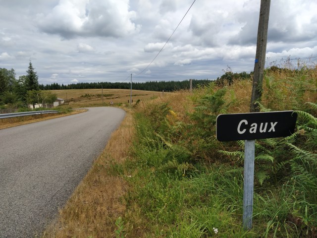
Leaving Caux behind us we clung to the verge (more flowers) as the few cars that passed us drove at speed. The Correze has abandoned the experiment with a limit of 80kph and so you can whizz’ along at 90kph. Walkers beware!

Soon we reached the right turn for Vieillascaux. Thank goodness for the yellow balise on the road sign as Lou was convinced I was leading him on a wild goose chase. This road led us down, at first, past broom bushes and ripening blackberries

and then up to a farm. Another prominent yellow splash pointed us around the farmyard.
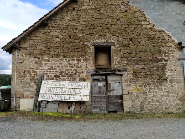
By now himself was striding away as usual. I was bonjour-ed by a young girl as I took a photo of her father’s (?) sign of protest about wind farms
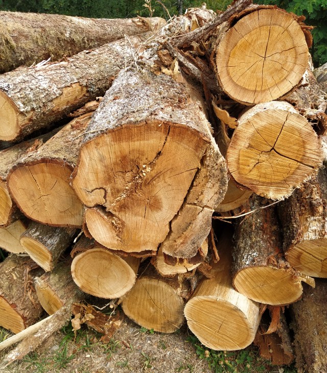
I took several shots here as I love a cluttered farmyard and this one was pretty full of diverse objects. In contrast there were some very neat piles of wood, ready cut for the winter stove and weighted down with bits of the ubiquitous corrugated iron and large stones. A nearby logpile smelled wonderful

I knew from Google earth and my fiche that this track would eventually take us back to the church from where we started so I let Lou go ahead as I strolled along enjoying the sights and smells. The track alternated between tarmac and rough stony earth and at one point there was a wonderful perfume but I couldn’t identify from what. We were at the highest point of the walk and there was a warm breeze blowing and some blue sky appearing. Good to be alive kind of walking.

A helicopter suddenly clattered away to my left. Possibly monitoring forest fires? This is the dangerous time of year with high temperatures, random winds and careless humans. The path undulated and wandered between fields and woodland.

The woods were made up of several different deciduous species, some of which I even recognised.


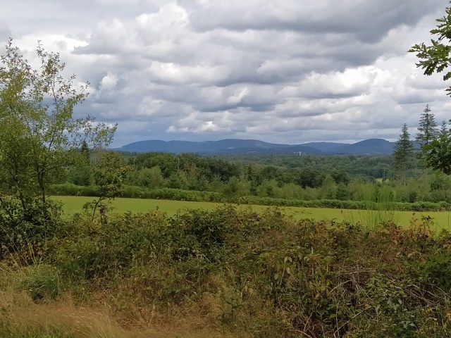
Suddenly on my right a vista opened up with misty mountains in the far distance. I wished I had a compass so I could work out later with the map which ones they were.
We seemed to be in the final descent which was into a beech wood.

I love beech woods. They remind me of life back in the UK when I would pick bunches of leaves to steep in glycerine for winter displays. Around our village there are similar trees that confused me until a friend told me they are hornbeam.
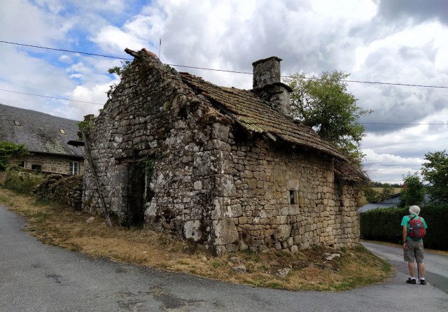
The last part of the walk brought us back to the village through a farm. Possibly not a working one given the state of its buildings?

Once beautiful but needing repair. The immediate village, or hamlet, consists of this farm, three houses, a cross and a church.

There was a group of fat yew trees around the cross and I wondered if they signified the presence of a former graveyard but no amount of internet searching has revealed any information about the village or its church.
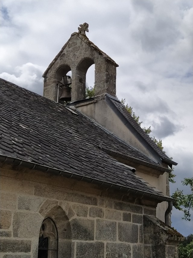
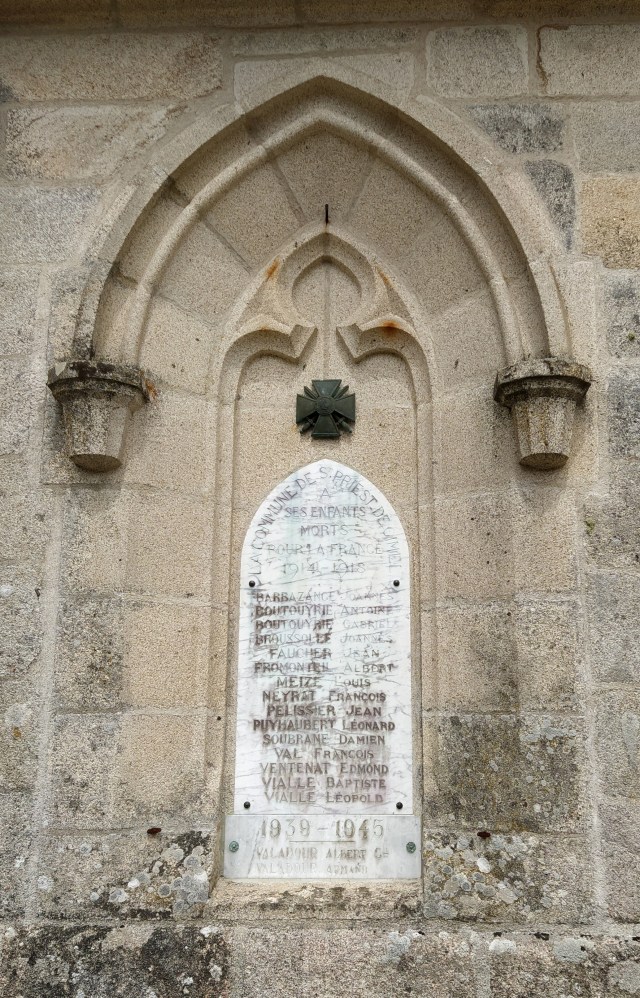
The church was locked and appears to be missing a bell or two. Its war memorial set into the church wall seems sadly neglected.
But someone must live here as a van turned up with a cherry picker on top and two workers emerged and seemed to be busy with internet cables as we were changing our shoes.
Lunch was on our minds and we hoped the small, possible parking space next to the etang would still be free. It was.
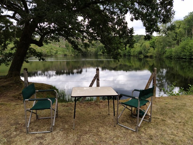
We ignored the wire fence and enjoyed the calm and the fact it had stayed dry after that first shower.
As to the mystery of the whereabouts of the real Saint Priest de Gimel? Well, we know it exists, we’ve been there…and, by proxy, so have you!