A while ago, back when the days were sunny and long…and very hot, a friend told me about the lac de Coiroux. I had told her we had walked around a lake in the Correze and she told me this one was closer while still being in that department. Of course, i googled it and discovered it was not only the lake and obligatory ‘plage; but had a campsite, a children’s activity centre and a popular golf course. Too busy for us, I decided, in the middle of the summer season but maybe later….
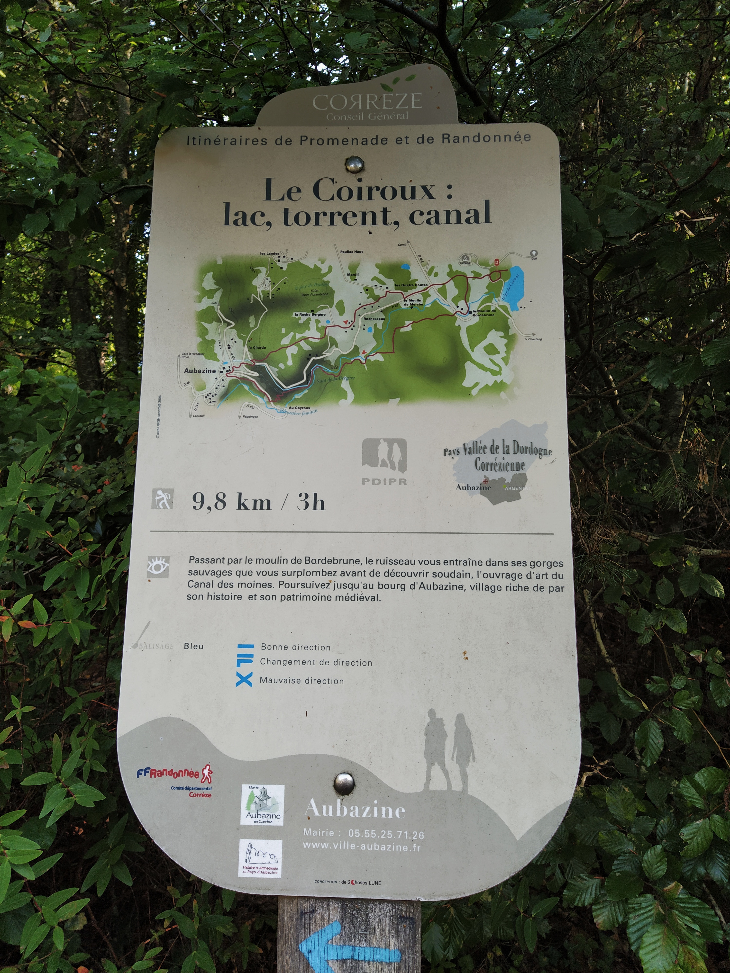
The days are shorter and cooler now and after the last circumnavigation of a lake ‘I’m only the chauffeur’ had commented that perhaps we should try longer walks. I remembered lac de Coiroux and set about finding a randonnee around it. The ‘parcours nature de Coiroux’ popped up, stating it was 8km and ‘facile’. I printed off the fiche which, annoyingly , was one of those vague maps which show a red line but no map details and the accompanying words waffled about the zones we would walk through but no actual directions. I should have smelled trouble!

We had to wait until the end of the week for a dry day so were keen to walk again. The drive was quite twisty once we left the main road towards Tulle but very pretty with the autumn colours deepening.

We were relying on road signs as the gps couldn’t find any of the villages situated close to the lake. i had discovered that google earth had not just travelled the roads nearby but driven into the carpark so I was able to scan around and had spotted what I believed to be the panneau for ‘our’ walk. The first mistake!
The golf course featured heavily on the signs as we drove closer so it was very easy to follow.
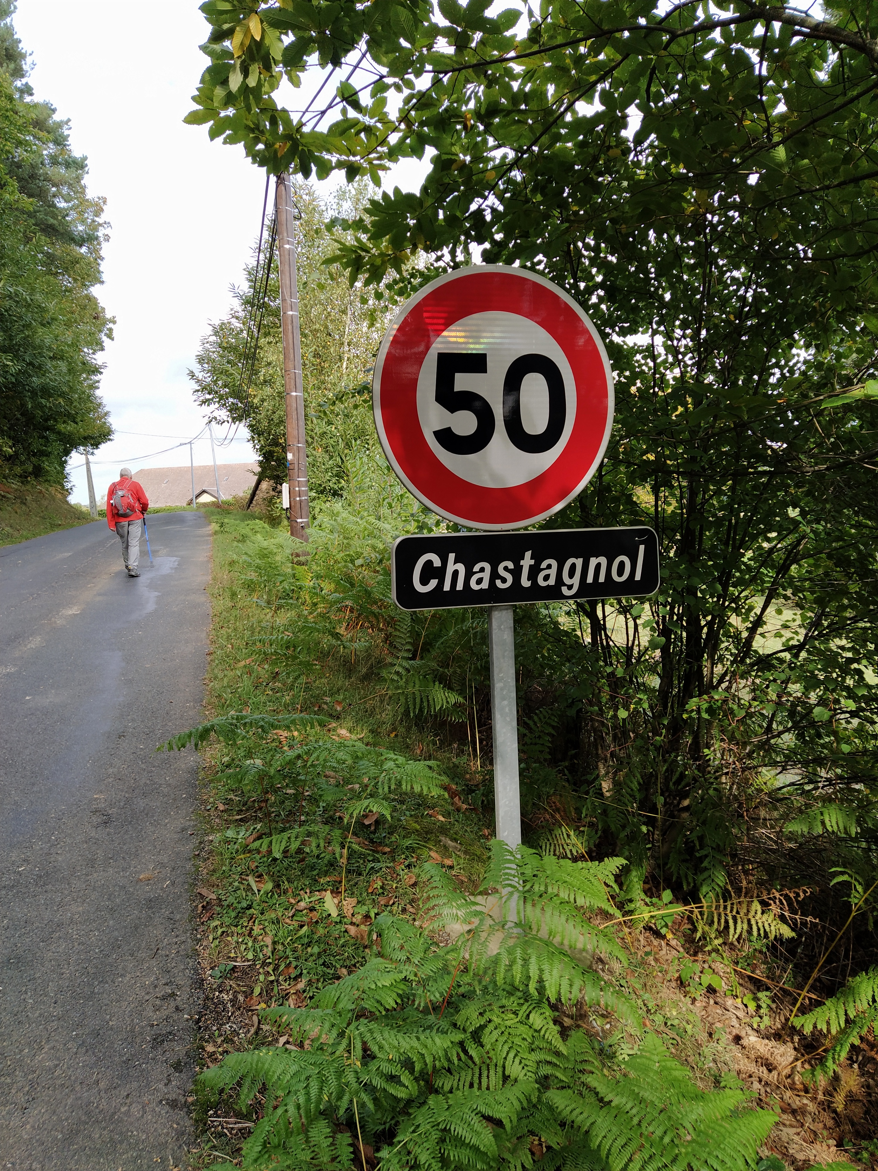
Chastagnol, the village in large black print on the map was a tiny hamlet with one of those tiny black name boards attached to the 50k speed limit reminder. No wonder the gps didn’t consider it a destination worthy of the name.
In the car park I realised the sign i had confidently predicted was for the parcours was, in fact for a 9.5 km walk with blue balise to Aubazine and back. The sign for us was at the entrance to the car park and gave no indication at all about where the walk started. After the usual faff of putting on boots and finding sticks we set off up the steps next to the ‘wrong’ walk hoping the yellow balise for ours would soon appear. mistake number two.
At the top of the steps we were faced with the path to the left going to Aubazine and a path in front of us leading past the children’s centre. An excited goat bleated pitifully from inside his shelter while his companion just gazed at us quietly, knowingly? The view of the lake was lovely and himself pointed out picnic tables ‘for later’.

After walking for a while across the grass we entered the trees, still not having seen any suggestion of a yellow balise anywhere. Time for a rethink. Back to the car park and a minute scrutiny of the photocopied piece of the ign map that i always take…thank goodness! According to the map there seemed to be a path marked on the far side of the car park so we set off in that direction. Sure enough there was a large sign announcing the ‘parcours nature’ but still no indication of where it may be. We walked up the road out of the car park and saw a gloomy path on our left marked very clearly with the blue balise. No yellow but a lurid green, plus a plastic sign that had PN on it and arrows in each direction. ‘PN’ must stand for parcours nature’, I suggested, let’s just go for it.’ So we did!

The path was gloomy because it was under the trees, chestnut trees, as evidenced by the ground littered with them. I should have brought a bag. I told Lou.

He was still not convinced we were on the right path but when we came to a junction with a very clear blue balise to the left and the lurid green plus plastic PN to our right, we were mollified that this was indeed the parcours.

The path was lighter now as it ran along the side of fields with cows but still with chestnuts underfoot. It rose and fell and views opened out on our left. The campsite seemed to be somewhere on our right now, hidden by the trees but with occasional signs for it pointing back the way we had come.

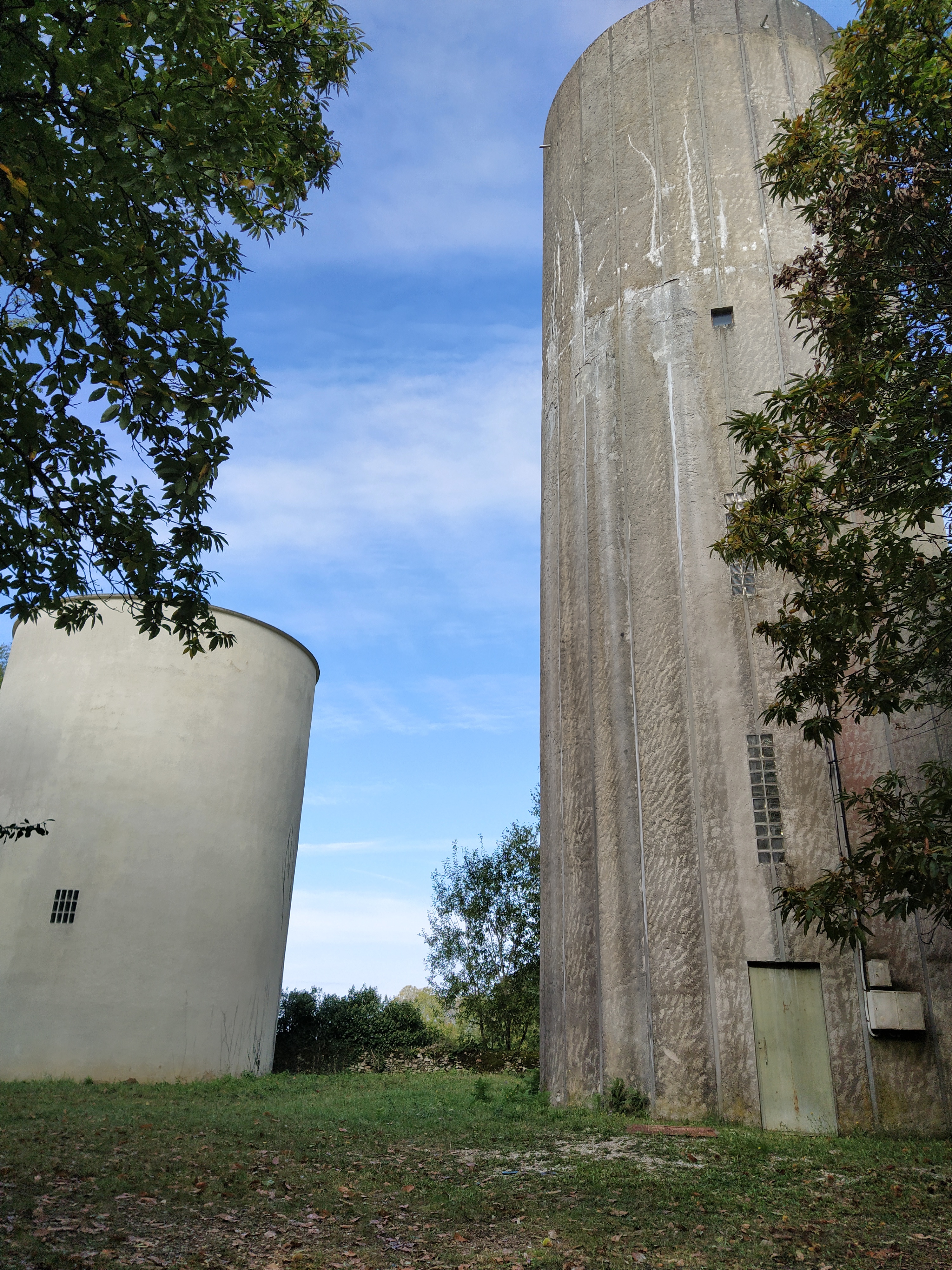
And so we progressed. In and out of the forest, past two enormous water towers,
winding through tiny hamlets with big vegetable patches, down tracks with warning signs about cows or sheep on the move….

but always having to hunt for the balise to decide which direction to take. From experience we knew that the paths we were following might not feature on the map. In fact, the water towers were the only thing I could positively identify.

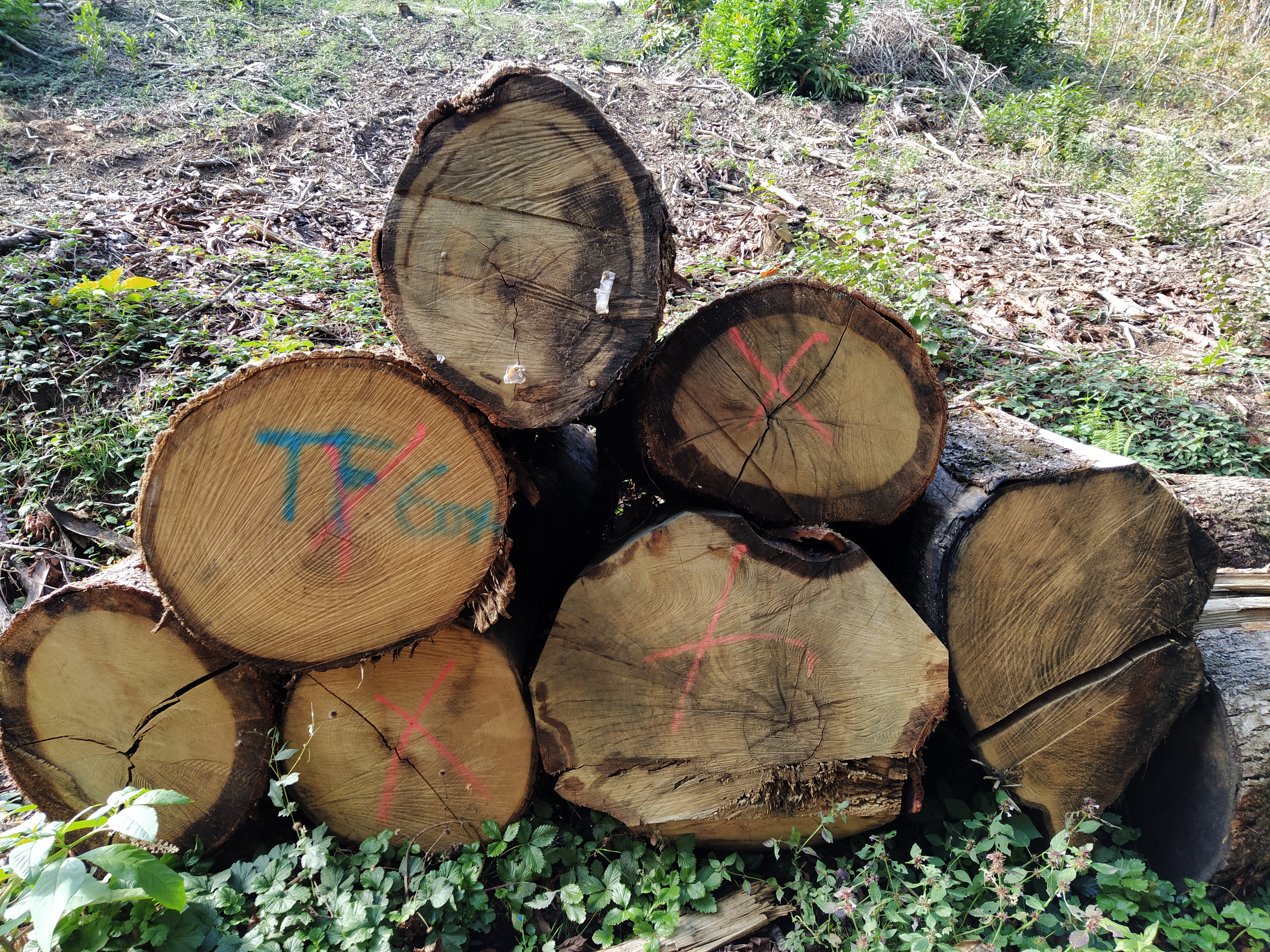
At times we walked along the edge of the golf course, the immaculate greens contrasting wildly with the landscape we had been walking through, especially when we reached an area of logging destruction. The debris of felled trees was everywhere but the wild flowers were flourishing in the sudden light.

Further on we came down onto a wide track and, ever curious, i walked back to its start to read a large sign. It was telling us we were on land belonging to ‘international paper’ and no admittance. However, the plastic ‘PN’ was in evidence so on we walked.
Back by the golf course, walking between the greens and undisturbed woodland was most pleasant, if you ignored the posters warning of flying golf balls with the power to kill or maim. And remembered to avoid the electric fence of 6000 volts!

A little further on we came to a crossroads of tracks with a beautiful wayside cross. It was carved from wood, decorated with climbing ivy and mounted on a stone plinth.

We looked in vain for a balise of any description. The only one was a plastic PN pinned to a tree just before the crossroads. A large lurid green arrow was splashed across a tree and gave the impression we should walk straight on. To our right, the logging had taken down every tree for about a hundred yards so nothing to pin or paint on. So we continued down the track. Mistake number three!

We could see a house further down on our left and walked past its wood pile. Suddenly we found ourselves at a t junction with a tarmac road. On our right was a name sign. La Chapelle. Lou was scanning his map (I do one each!) and shouted he had found La Chapelle. Right on the edge of our photocopy. I could see the way back and it looked a long walk. We pushed on to the right and just as we were wondering if we were going into someone’s front garden a tractor came towards us. Happily, he stopped and I explained where we had come from and where we needed to go. He told me the grassy track he had just come up wasn’t ‘interdit’ and if we followed it to its end at the ‘chemin goudronee’ (tarmac) we could turn left and then right at Maisonneuve and find the lake straight ahead.


What a star! We followed his advice and ultimately made it back to the lake, walking along the main road for what seemed like ages.
At Chastagnol, a chap working in his garden, hailed us and told us we had profited from the only dry day. Indeed we had, I didn’t want to imagine that extra walk in the open along a busy road in the rain!

We made it back…three hours of walking instead of two. The picnic was very welcome!
footnote: himself had chosen Strava to record the day’s walk. 11.6km instead of 8km, that longer walk he wanted!

Wow. That walk would have left me consigned to the couch for a couple of days. Pretty photos.
LikeLike
It was a bit further than I was happy walking! My toes start to tingle around 6/7km. Lou wonders if my booked are too narrow across the toes…I think it my subconscious saying ‘enough already!’ 🙂
LikeLike